Atkinson .:. Cambridge
Atkinson, Thomas Dinham, Cambridge Described and Illustrated. Being a Short History of the Town and University. London / Cambridge: Macmillan and Company Limited / Macmillan and Bowes, 1897. xxxvii, 528 pages with illustrations and index. Cloth with top edge gilt. Large octavo. 1574 g�* A short history of the Town and University. Introduction by John Willis Clark, MA, FSA, Late Fellow of Trinity College. Preface. Abbildungen auf Tafeln und im Text. 2 Faltkarten. General index. Index of portraits. - Schwache Gebrauchsspuren, Einband leicht gebräunt, Block etwas locker.
Atkinson | Grossbritannien | 1850-1899
Buchnummer 101205 CHF 70.00 | EUR 76.30 | | 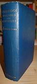 |
Atlantis .:. Skulpturen in der Wandelhalle
Marohn, Karl Heinz [Red.], Atlantis. Skulpturen in der Wandelhalle. Köln: Greven, 1985. 153 Seiten mit Abbildungen. Klappenbroschur. 4to quer. 736 g�* Eine Ausstellung im Forum für Kunst "Die Wandelhalle", Köln (Poll) 18. Mai - 30. Juni 1985; Organisation der Ausstellung Karl Heinz Marohn und Mary Noële Dupuis. Mary Noële Dupuis, Dominique Arel, Rainer Mang, Adi Meier-Grolmann, Peter J. Mönnig, Zbyszek Oksiuta, Manfred Ott, Jacques Taris. - Umschlag etwas lichtrandig / gebräunt und fleckig.
Atlantis | Kunstausstellung | Ausstellungskatalog | Bildhauerei | Plastik | Sculpture
Buchnummer 157368 CHF 25.00 | EUR 27.25 | |  |
Atlas .:. des Universums
Moore, Patrick, Der grosse Atlas des Universums. Planeten, Sonnensysteme, Galaxien, unser Weltall in mehr als 800 Karten, Farbfotos, Zeichnungen und Diagrammen. München: Mosaik-Verlag, 1990. 271 Seiten mit Abbildungen und Register. Pappband (gebunden) mit Schutzumschlag. Gross- 4to. 2151 g�* Aus dem Englischen von Werner E. Celnik ... Bearb. der dt. Ausgabe: Rhea Lüst. Illustriert : Paul Doherty .... - Schwache Gebrauchsspuren.
ISBN 3-570-04626-5 | Atlas | Astronomie | Atlanten | Geodaesie | Kartographie |
Buchnummer 132561 CHF 35.00 | EUR 38.15 | |  |
Atlas .:. zu G. Studer's Topographischen Mittheilungen
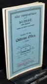
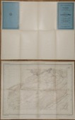
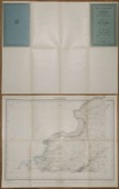
[Studer, Gottlieb, 1804-1890] Atlas zu G. Studer's Topographischen Mittheilungen. 1e Sammlung. Bern: Huber, [1843]. 5 gefaltete Blätter, lithogaphierte Panoramen. Kartonmappe, 18 x 12 cm. 89 g�* Gemäss Innendeckel umfasst diese erste Sammlung 6 Ansichten; davon sind hier vorhanden: II: Von der Gamchilüke. 18 x 38 cm; IV: Aussicht vom Gipfel der Jungfrau, gegen Osten. 18 x 64 cm; V: Rundsicht vom Aeggischhorn im Wallis. 3 Blätter, zusammen 18 x 193 cm. - Schwach stockfleckig, die 3 Blätter "Aeggischhorn" mit Reisszweckenlöchern, Rückenkanten leicht aufgeplatzt, Rücken leicht gebräunt und von Hand beschriftet.
Atlas | Geodaesie | Kartographie | 1800-1849 | Helvetica | Schweiz | Geogr Berge | Alpinismus | Alpinistik
https://comenius-antiquariat.ch/buch/121482.html
Buchnummer 121482 CHF 250.00 | EUR 272.50 | |  |
Atlas der Schweiz .:. interaktiv
Hurni, Lorenz u.a. [Red.], Atlas der Schweiz interaktiv. 3D-Topografie und Statistikkarten = Atlas de la Suisse interactif [...]. Wabern: Bundesamt für Landestopographie, 20. 1 CD-ROM + Begleitbuch (64 S.: Illustrationen, graph. Darst., Kt.). Schachtel 22 x 16 x 2 cm. 272 g�* Systemvoraussetzungen Apple PowerMacintosh: PowerPC-Prozessor; mind. 35 MB freier Arbeitsspeicher (RAM); System Mac OS 8; CD-ROM-Laufwerk; Grafikkarte mit 16 oder 24 Bit Farbauflösung (True color); Farbmonitor mit mind. 800 x 600 Bildpunkten�Systemvoraussetzungen IBM-kompatibler Computer (PC): Pentium-Processor; mind. 35 MB freier Arbeitsspeicher (RAM); Windows 95/Windows98, NT4.0; CD-ROM-Laufwerk; SVGA-Grafikkarte mit 16 oder 24 Bit Farbauflösung; Farbmonitor mit mind. 800 x 600 Bildpunkten. Text deutsch, englisch, französisch und italienisch. - Buch mit schwachen Gebrauchsspuren.
ISBN 3-302-09520-1 | ISBN-13 978-3-302-09520-2 | Atlas der Schweiz | Helvetica | Schweiz | Geodaesie | Kartographie
Buchnummer 152593 CHF 45.00 | EUR 49.05 | |  |
|
 letzte Eingänge SI